|
|
|
|
|
|
|
|
|
|
|
|
|
|
|
|
CONTENTS
1.4 Summary of Construction Activities
1.5 Summary of EM&A Programme Requirements
1.6 Status of Other Statutory Environmental Requirements
2....... Summary of EM&A Results
2.1 Environmental Site Inspection
2.3 Marine Water Quality Monitoring
2.3.2 Action and Limit Levels for Marine Water Quality Monitoring
2.3.4 Comparison of Monitoring Results with EIA Predictions
2.4 Pilot Test on the Efficiency of Silt Curtain System
2.5 Marine Water Quality Monitoring for Hydrotesting for the Subsea Gas Pipelines
2.6 Post-construction Water Quality Monitoring
2.6.2 Action and Limit Levels for Marine Water Quality Monitoring
2.7.2 Action and Limit Levels for Marine Mammal Monitoring
2.7.4 Summary and Comparison of Monitoring Results with EIA Predictions
2.8 Marine Mammal Exclusion Zone Monitoring
2.9 Records of Operating Speeds and Marine Travel Routes of Working Vessels
2.10 Implementation Status of Environmental Mitigation Measures
2.11 Summary of Exceedances of the Environmental Quality Performance Limit
2.12 Summary of Environmental Complaints, Notification of Summons and Successful Prosecutions
3....... Conclusion and Recommendations
Annexes
Annex B Construction Programme
Annex C Environmental Mitigation Implementation Schedule (EMIS)
Annex D Status of Statutory Environmental Requirements
Annex F Graphical Presentations of Marine Water Quality Monitoring Results
List of Tables
Table 1.1 Contact Information of Key Personnel
Table 1.2 Major Construction Activities Undertaken
Table 1.3 Summary of Status for the EM&A Programme under the Updated EM&A Manual
Table 2.1 Summary of Aspects for Key Observations Recorded during Site Inspections
Table 2.2 Quantities of Waste Generated for FEP-01/558/2018/A
Table 2.3 Quantities of Waste and Marine Sediment Generated for FEP-02/558/2018/A
Table 2.4 Quantities of Waste and Marine Sediment Generated for FEP-03/558/2018/B
Table 2.5 Location of Marine Water Quality Monitoring Stations
Table 2.6 Action and Limit Levels for Marine Water Quality Monitoring
Table 2.7 Event and Action Plan for Marine Water Quality Monitoring
Table 2.10 Efficiencies of Silt Curtain Systems for Dredging and Jetting Operations
Table 2.12 Action and Limit Levels for Marine Water Quality Monitoring
Table 2.13 Action and Limit Levels for Marine Mammal Monitoring
Table 2.14 Event and Action Plan for Marine Mammal Monitoring
Table 2.15 Running Quarterly STG and ANI for Finless Porpoise
Table 2.16 Summary of PAM data for each Location
Table 2.17 Marine Mammal Exclusion Zone Requirements
Table 2.18 Monitoring Results for Marine Mammal Exclusion Zone Monitoring
List of Figures
Figure 1.1 Indicative Location of Key Project Components
Figure 1.2 Location and Works Area of GRS at BPPS
Figure 1.3 Location and Works Area of GRS at LPS
Figure 2.1 Marine Water Quality Monitoring Location
Figure 2.2 Monitoring Locations for Silt Curtain Pilot Test for Dredging Operation for LPS Pipeline
Figure 2.3 Monitoring Locations for Silt Curtain Pilot Test for Dredging Operation for BPPS Pipeline
Figure 2.5 Monitoring Locations for Floating Silt Curtain Pilot Test for Jetting Operation
Figure 2.6 Water Quality Monitoring Locations for Hydrotesting for the Subsea Gas Pipelines
Figure 2.7 Vessel-based Marine Mammal Survey Location
Figure 2.8 Underwater PAM Survey Location
Figure 2.9 Distribution of Finless Porpoise Sightings in December 2020 and July – October 2021
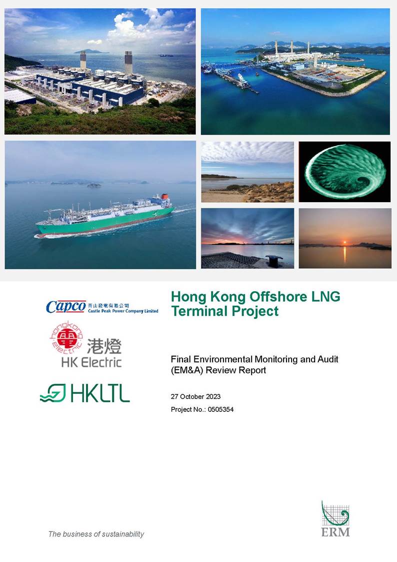
To support the increased use of natural gas in Hong Kong from 2020 onwards, Castle Peak Power Company Limited (CAPCO) and The Hongkong Electric Co., Ltd. (HK Electric) have identified that the development of an offshore liquefied natural gas (LNG) receiving terminal in Hong Kong using Floating Storage and Regasification Unit (FSRU) technology (‘the Project’) presents a viable additional gas supply option that will provide energy security through access to competitive gas supplies from world markets. The Project will involve the construction and operation of an offshore LNG import facility to be located in the southern waters of Hong Kong, a double berth jetty, and subsea pipelines that connect to the gas receiving stations (GRS) at the Black Point Power Station (BPPS) and the Lamma Power Station (LPS). To demarcate the works between different parties, the following Further Environmental Permits (FEPs) were issued for the Project:
§ the double berth jetty at LNG Terminal under the Hong Kong LNG Terminal Limited (HKLTL), joint venture between CAPCO and HK Electric (FEP-01/558/2018/A) – construction commenced on 27 November 2020;
§ the subsea gas pipeline for the BPPS and the associated GRS in the BPPS under CAPCO (FEP-03/558/2018/B) – construction commenced on 23 September 2020; and
§ the subsea gas pipeline for the LPS and the associated GRS in the LPS under HK Electric (FEP-02/558/2018/A) – construction commenced on 13 December 2020.
The construction of the Project was completed on 27 June 2023. This is the Final EM&A Review Report presenting the EM&A works carried out for the construction phase of the Project between 23 September 2020 and 27 June 2023 in accordance with the Updated EM&A Manual. A summary of monitoring and audit activities conducted for the construction phase is listed below:
|
Activities |
Number of Sessions |
|
For FEP-01/558/2018/A |
|
|
Marine Mammal Monitoring (vessel-based line transect survey) |
36 |
|
Passive Acoustic Monitoring (C-POD deployment) |
Completed for construction phase |
|
Marine Mammal Exclusion Zone Monitoring |
During percussive piling works for construction of the Jetty |
|
Environmental Site Inspection |
28 |
|
For FEP-02/558/2018/A |
|
|
Marine Water Quality Monitoring |
54 |
|
Marine Water Quality Monitoring for Hydrotesting for the LPS Pipeline |
10 |
|
Marine Mammal Exclusion Zone Monitoring |
During dredging / jetting operation for construction of LPS Pipeline |
|
Pilot Test on the Efficiency of Silt Curtain System – Cage-type Silt Curtain for Dredging Operation |
1 |
|
Environmental Site Inspection |
24 |
|
For FEP-03/558/2018/B |
|
|
Marine Water Quality Monitoring |
112 |
|
Marine Water Quality Monitoring for Hydrotesting for the BPPS Pipeline |
11 |
|
Marine Mammal Exclusion Zone Monitoring |
During dredging / jetting operation for construction of BPPS Pipeline |
|
Pilot Test on the Efficiency of Silt Curtain System – Cage-type Silt Curtain for Dredging Operation |
1 |
|
Environmental Site Inspection |
73 |
|
For FEP-02/558/2018/A and FEP-03/558/2018/B |
|
|
Pilot Test on the Efficiency of Silt Curtain System – Cage-type Silt Curtain for Jetting Operation |
1 |
|
Pilot Test on the Efficiency of Silt Curtain System – Floating Silt Curtain for Jetting Operation |
1 |
Environmental auditing works, including regular site inspections of construction works conducted by the ET, audit of implementation of Waste Management Plan, and review of the acceptability of operating speeds and marine travel routes of working vessels, including checking of compliance with the approval conditions given by the Director of Environmental Protection for the entry of working vessels within marine parks, in pursuant to Condition 3.1 of FEP-01/558/2018/A, Condition 3.4 of FEP-02/558/2018/A and Condition 3.4 of FEP-03/558/2018/B, were conducted during the construction phase of the Project as appropriate. No non-compliance of environmental statutory requirements was identified.
Breaches of Action and Limit Levels
There were no Project-related Action and Limit Level exceedances for marine water quality monitoring as well as marine water quality monitoring for hydrotesting for the BPPS Pipeline and LPS Pipeline during the construction phase of the Project. There were no Project-related Action and Limit Level exceedances for the post-construction water quality monitoring of the Project.
There were no breaches of Action and Limit Levels for marine mammal monitoring during the construction phase of the Project.
Environmental Complaints, Notification of Summons and Successful Prosecution
There were three environmental complaints received during the construction phase of the Project, including:
§ Environmental Complaints #1 & #2 on the absence of silt curtain for post-trenching operation of the LPS Pipeline: Upon investigation, no post-trenching operation was conducted for the LPS Pipeline in the past two weeks upon receipt of complaints (i.e. between 6 and 20 January 2022). Only survey works for confirming seabed profile in the vicinity of the LPS Pipeline were conducted, which did not result in any unacceptable environmental impacts to the surrounding and the works were in compliance with the environmental requirements under FEP-02/558/2018/A and the approved EIA report (Register No.: AEIAR-218/2018). The two complaints on silt curtain not deployed during post-trenching operation are thus considered invalid.
§ Environmental Complaint #3 on the alleged dumping of waste into sea between Shek Kwu Chau and Tai A Chau: Upon investigation, no construction & demolition (C&D) waste was generated from the Project in the past two weeks upon receipt of complaint (i.e. between 7 and 21 September 2022). There is no evidence showing any unacceptable waste management practice for the Project. Environmental protection / mitigation measures were observed to be implemented properly in accordance with the Implementation Schedule as well as the environmental requirements under the Further Environmental Permits and the approved EIA report (Register No.: AEIAR-218/2018). The complaint is thus considered invalid.
There were no notification of summons and successful prosecutions recorded during the construction phase of the Project.
Reporting Changes
There were no reporting changes during the construction phase of the Project.
Comments, Recommendations and Conclusions for the Construction Phase
The recommended environmental mitigation measures for the Project were effectively implemented and the EM&A programme undertaken by the ET has effectively monitored the construction activities as well as ensured proper implementation of mitigation measures during the construction phase. The monitoring and audit activities conducted during the construction phase of the Project have been reviewed and are considered effective. Based on the EM&A findings for the construction phase, the environmental performance for the construction of the Project is generally in line with the EIA predictions and considered acceptable.
The commencement of operation of the Project is on 3 July 2023. The potential environmental impacts during operation are mainly associated with seawater and effluent discharges associated with the LNG Terminal operation. Operation phase water quality monitoring exercise will be carried out for one year at a frequency of once per week. The monitoring results will be presented in the water quality monitoring reports for the first year of operation of the LNG Terminal to be prepared every quarter and at the end of the first year of operation of the LNG Terminal.
To support the increased use of natural gas in Hong Kong from 2020 onwards, Castle Peak Power Company Limited (CAPCO) and The Hongkong Electric Co., Ltd. (HK Electric) have identified that the development of an offshore liquefied natural gas (LNG) receiving terminal in Hong Kong using Floating Storage and Regasification Unit (FSRU) technology (‘the Project’) presents a viable additional gas supply option that will provide energy security through access to competitive gas supplies from world markets. The Project will involve the construction and operation of an offshore LNG import facility to be located in the southern waters of Hong Kong, a double berth jetty, and subsea pipelines that connect to the gas receiving stations (GRS) at the Black Point Power Station (BPPS) and the Lamma Power Station (LPS).
The Environmental Impact Assessment (EIA) Report for the Project was submitted to the Environmental Protection Department (EPD) of the HKSAR Government in May 2018. The EIA Report (EIAO Register No. AEIAR-218/2018) was approved by EPD and the associated Environmental Permit (EP) (EP-558/2018) was issued in October 2018.
An application for Further Environmental Permits (FEPs) were made on 24 December 2019 to demarcate the works between the different parties. The following FEPs were issued on 17 January 2020 and the EP under EP-558/2018 was surrendered on 5 March 2020.
§ the double berth jetty at LNG Terminal under the Hong Kong LNG Terminal Limited (HKLTL), joint venture between CAPCO and HK Electric (FEP-01/558/2018/A) ([1]) – construction commenced on 27 November 2020;
§ the subsea gas pipeline for the BPPS and the associated GRS in the BPPS under CAPCO (FEP-03/558/2018/B) ([2]) – construction commenced on 23 September 2020; and
§ the subsea gas pipeline for the LPS and the associated GRS in the LPS under HK Electric (FEP-02/558/2018/A) ([3]) – construction commenced on 13 December 2020.
The location of these components is shown in Figures 1.1, 1.2 and 1.3.
The construction of the Project was completed on 27 June 2023.
This is the Final EM&A Review Report for the Project which summarises the key findings of the EM&A programme for the construction phase of the Project between 23 September 2020 and 27 June 2023 in accordance with the Updated EM&A Manual and the requirements of the Further Environmental Permits (FEP-01/558/2018/A, FEP-02/558/2018/A & FEP-03/558/2018/B).
The organisation structure of the Project is shown in Annex A. The key personnel and contact details are summarised in Table 1.1 below.
Table 1.1 Contact Information of Key Personnel
|
Party |
Position |
Name |
Telephone |
|
CAPCO / HKLTL (For FEP-01/558/2018/A and FEP-03/558/2018/B)
|
Senior Manager - Environment |
Karen Lui |
2678 8282 |
|
HK Electric / HKLTL (For FEP-01/558/2018/A and FEP-02/558/2018/A)
|
Head of Mechanical Engineering, Projects Division
|
Norman Chan
|
3143 3819
|
|
Environmental Team (ET) (ERM-Hong Kong, Limited)
|
ET Leader
|
Raymond Chow
|
2271 3281 |
|
Independent Environmental Checker (IEC) (Mott MacDonald Hong Kong Limited)
|
IEC |
Lydia Chak |
2585 8473 |
|
Contractor (CNOOC Offshore Oil Engineering Co. Ltd.) |
Environmental Manager |
H Y Tang |
6111 5789
|
|
|
|||
The programme of the construction is shown in Annex B.
The details of the major construction activities undertaken are listed in Table 1.2 below:
Table 1.2 Major Construction Activities Undertaken
|
FEP |
Land-based Works |
Marine-based Works |
|
FEP-01/558/2018/A |
§ Topside installation works § Piping installation works § System commissioning |
§ Jacket installation § Pile installation § Topsides installation § Piping installation |
|
FEP-02/558/2018/A |
§ Preparation of intermediate hydrotesting for pipeline § System commissioning |
§ Pre-trenching § Dredging works § De-burial (pre-trenching) of pre-installed pipeline by Mass Flow Excavator (1) § Pipe-laying works § Intermediate hydrotesting for pipeline § Post-trenching § Rock armour placement § Final hydrotest |
|
FEP-03/558/2018/B |
§ Preparation works at the new GRS (including set-up of site offices, erection of hoarding and mobilisation of wastewater treatment facilities) § Plate Load Test – Pipe Rack § Cable pulling § Construction of reinforced concrete foundation § Underground drainage works § Drainage installation § Seawall construction § Backfill and permanent paving works § Excavation, drainage and backfilling works § Pipe rack – erection and assembly § Building superstructure works § Piping installation works § Box culvert works § Instrumentation and control installation works § Electrical and telecommunication installation works § System commissioning |
§ Pipe-laying works § Pre-trenching § Sheet pile installation § Shore-pull operations § Post-trenching § Rock armour placement § Removal of cofferdam § Final hydrotest |
Remark: (1) Mass flow excavator is a variance of jetting machine.
The status of EM&A Programme for all environmental aspects required under the Updated EM&A Manual are presented in Table 1.3. The requirements of relevant environmental monitoring, including monitoring parameters, Action and Limit Levels, Event and Action Plan(s), environmental mitigation measures, etc. are presented in Section 2.
Table 1.3 Summary of Status for the EM&A Programme under the Updated EM&A Manual
|
Aspects |
Relevant FEP(s) |
Status |
|
Water Quality |
||
|
Baseline Monitoring |
FEP-01/558/2018/A FEP-02/558/2018/A FEP-03/558/2018/B |
§ Completed |
|
Efficiency of Silt Curtain System |
FEP-02/558/2018/A FEP-03/558/2018/B |
§ Completed for cage-type silt curtain for dredging operation (under FEP-02/558/2018/A and FEP-03/558/2018/B) § Completed for cage-type silt curtain for jetting operation (under FEP-02/558/2018/A and FEP-03/558/2018/B) § Completed for floating silt curtain for jetting operation (under FEP-02/558/2018/A and FEP-03/558/2018/B) |
|
Construction Phase Monitoring |
FEP-02/558/2018/A FEP-03/558/2018/B |
§ Completed for FEP-02/558/2018/A and FEP-03/558/2018/B |
|
Post-Construction Monitoring |
FEP-02/558/2018/A FEP-03/558/2018/B |
§ Completed for FEP-02/558/2018/A and FEP-03/558/2018/B |
|
Monitoring for Hydrotesting for the Subsea Gas Pipelines |
FEP-02/558/2018/A FEP-03/558/2018/B |
§ Completed for FEP-02/558/2018/A and FEP-03/558/2018/B |
|
First-year of LNG Terminal Operation |
FEP-01/558/2018/A |
§ To be implemented during LNG Terminal operation |
|
Maintenance Dredging |
FEP-01/558/2018/A |
§ To be implemented during maintenance dredging |
|
Waste Management |
||
|
Audit of Waste Management Practice |
FEP-01/558/2018/A FEP-02/558/2018/A FEP-03/558/2018/B |
§ On-going |
|
Ecology |
||
|
Baseline Monitoring (Vessel-based Line Transect Survey and Passive Acoustic Monitoring) |
FEP-01/558/2018/A
|
§ Completed |
|
Construction Phase Monitoring (Vessel-based Line Transect Survey and Passive Acoustic Monitoring) |
FEP-01/558/2018/A |
§ Completed |
|
Post-Construction Monitoring (Vessel-based Line Transect Survey and Passive Acoustic Monitoring) |
FEP-01/558/2018/A |
§ On-going |
|
Marine Mammal Exclusion Zone Monitoring |
FEP-01/558/2018/A FEP-02/558/2018/A FEP-03/558/2018/B |
§ Completed for FEP-01/558/2018/A (marine mammal exclusion zone with 500m radius) and FEP-02/558/2018/A and FEP-03/558/2018/B (marine mammal exclusion zone with 250m radius) |
|
Environmental Site Inspection |
||
|
Regular Site Inspection |
FEP-01/558/2018/A FEP-02/558/2018/A FEP-03/558/2018/B |
§ Completed |
|
Records of Operating Speeds and Marine Travel Routes for Working Vessels |
FEP-01/558/2018/A FEP-02/558/2018/A FEP-03/558/2018/B |
§ Completed |
|
Environmental Log Book |
FEP-01/558/2018/A FEP-02/558/2018/A FEP-03/558/2018/B |
§ On-going
|
The environmental licenses and permits, including further environmental permits, registration as chemical waste producer, construction noise permits, wastewater discharge license, marine dumping permits, etc., which were valid during the construction phase of the Project. No non-compliance with environmental statutory requirements, including FEP conditions (status of submission) under the EIA Ordinance, was identified. The status of statutory environmental requirements is presented in Annex D.
The
environmental mitigation implementation schedule (EMIS) is presented in Annex C.
The EM&A programme for the Project required environmental monitoring for marine water quality and marine mammals as well as environmental site inspections for air quality, construction noise, water quality, waste management, marine ecology, landscape and visual, and hazard to life impacts. As presented in Section 1.5, environmental site inspections and audit on waste management practice, marine water quality monitoring, including pilot tests on the efficiency of silt curtain system, marine mammal monitoring (i.e. vessel-based line transect survey and passive acoustic monitoring) and marine mammal exclusion zone monitoring were conducted during the construction phase, and the findings are summarised below.
Regular environmental site inspections were carried out with the Contractor and Project Proponents to confirm the implementation of appropriate environmental protection and pollution control mitigation measures for air quality, construction noise, water quality, waste management, marine ecology, landscape and visual, and hazard to life impacts under the Project. During the construction phase, 125 environmental site inspections were carried out, of which 28 sessions were for FEP-01/558/2018/A, 24 sessions were for FEP-02/558/2018/A and 73 sessions were for FEP-03/558/2018/B. The Independent Environmental Checker (IEC) attended 75 environmental site inspections as the IEC audits. Aspects for the key observations recorded during site inspections are summarised in Table 2.1. Details of observations recorded can be referred to the associated Monthly EM&A Reports. The environmental mitigation implementation schedule (EMIS) is presented in Annex C.
Table 2.1 Summary of Aspects for Key Observations Recorded during Site Inspections
|
Aspect |
Cumulative Number of Observations |
|
FEP-01/558/2018/A |
|
|
Air quality |
4 |
|
Water quality |
0 |
|
Waste management |
0 |
|
Ecology |
0 |
|
Visual |
0 |
|
Hazard to life |
0 |
|
Others |
0 |
|
Total |
4 |
|
FEP-02/558/2018/A |
|
|
Air quality |
3 |
|
Water quality |
0 |
|
Waste management |
1 |
|
Ecology |
0 |
|
Visual |
0 |
|
Hazard to life |
0 |
|
Others |
0 |
|
Total |
4 |
|
FEP-03/558/2018/B |
|
|
Air quality |
19 |
|
Water quality |
8 |
|
Waste management |
13 |
|
Ecology |
0 |
|
Visual |
0 |
|
Hazard to life |
0 |
|
Others |
3 |
|
Total |
43 |
Waste management audits were performed with reference to the Waste Management Checklists for the corresponding Waste Management Plans detailed in Annex E of the associated Monthly EM&A Reports during the regular environmental site inspections. No non-compliance for Contractor’s waste management practices was identified during the audits.
The quantities of different types of waste and marine sediment generated for the three FEPs are summarised in Tables 2.2, 2.3 and 2.4 with reference to the waste flow tables prepared by the Contractor. General refuse was generated under the three FEPs. Inert C&D materials (public fill) were generated under FEP-03/558/2018/B and disposed as public fill properly. Detailed waste flow tables can be referred to Annex F of the associated Monthly EM&A Reports.
Table 2.2 Quantities of Waste Generated for FEP-01/558/2018/A
|
Inert C&D Materials Generated (in ‘000kg) |
||||||
|
Month/Year |
Total Quantity Generated |
Hard Rock and Large Broken Concrete |
Reused in the Contract |
Reused in other Projects |
Disposed as Public Fill |
Imported Fill |
|
Oct 2020 -Sep 2021 |
0 |
0 |
0 |
0 |
0 |
0 |
|
Oct 2021 -Sep 2022 |
0 |
0 |
0 |
0 |
0 |
0 |
|
Oct 2022 – Jun 2023 |
0 |
0 |
0 |
0 |
0 |
0 |
|
Total |
0 |
0 |
0 |
0 |
0 |
0 |
|
C&D Wastes Generated |
||||||
|
Month/Year |
Metals (in ‘000kg3) |
Paper / Cardboard Packaging (in ‘000kg3) |
Plastics (in ‘000kg3) |
Chemical Waste |
Other (e.g. general refuse) (in ‘000kg) |
|
|
(in ‘000kg3) |
(in ‘000L) |
|||||
|
Oct 2020 -Sep 2021 |
0 |
0 |
0 |
0 |
0 |
39.080 |
|
Oct 2021 -Sep 2022 |
0 |
0 |
0 |
0 |
0 |
203.63 |
|
Oct 2022 – Jun 2023 |
0 |
0 |
0 |
0 |
0 |
195.59 |
|
Total |
0 |
0 |
0 |
0 |
0 |
438.30 |
|
Note: (1) Commencement date of construction for FEP-01/558/2018/A was 27 November 2020. |
||||||
Table 2.3 Quantities of Waste and Marine Sediment Generated for FEP-02/558/2018/A
|
Inert C&D Materials Generated (in ‘000kg) |
|||||||||||
|
Month/Year |
Total Quantity Generated |
Hard Rock and Large Broken Concrete |
Reused in the Contract |
Reused in other Projects |
Disposed as Public Fill |
Imported Fill |
|||||
|
Oct 2020 -Sep 2021 |
0 |
0 |
0 |
0 |
0 |
0 |
|||||
|
Oct 2021 -Sep 2022 |
0 |
0 |
0 |
0 |
0 |
0 |
|||||
|
Oct 2022 – Jun 2023 |
0 |
0 |
0 |
0 |
0 |
0 |
|||||
|
Total |
0 |
0 |
0 |
0 |
0 |
0 |
|||||
|
C&D Wastes Generated |
|||||||||||
|
Month/Year |
Metals (in ‘000kg3) |
Paper / Cardboard Packaging (in ‘000kg3) |
Plastics (in ‘000kg3) |
Chemical Waste |
Other (e.g. general refuse) (in ‘000kg) |
||||||
|
(in ‘000kg3) |
(in ‘000L) |
||||||||||
|
Oct 2020 -Sep 2021 |
0 |
0 |
0 |
0 |
0 |
85.04 |
|||||
|
Oct 2021 -Sep 2022 |
0 |
0 |
0 |
0 |
0 |
22.23 |
|||||
|
Oct 2022 – Jun 2023 |
0 |
0 |
0 |
0 |
0 |
0 |
|||||
|
Total |
0 |
0 |
0 |
0 |
0 |
107.27 |
|||||
|
Marine Sediment Generated (in ‘000m3) |
|||||||||||
|
Month/Year |
Total Quantity of Type L Generated |
Total Quantity of Type M Generated |
Reused in the Contract |
Reused in other Projects |
Open Sea Disposal |
||||||
|
Oct 2020 -Sep 2021 |
4.388 |
0 |
0 |
0 |
4.388 |
||||||
|
Oct 2021 -Sep 2022 |
0 |
0 |
0 |
0 |
0 |
||||||
|
Oct 2022 – Jun 2023 |
0 |
0 |
0 |
0 |
0 |
||||||
|
Total |
4.388 |
0 |
0 |
0 |
4.388 |
||||||
|
Note: (1) Commencement date of construction for FEP-02/558/2018/A was 13 December 2020. |
|||||||||||
Table 2.4 Quantities of Waste and Marine Sediment Generated for FEP-03/558/2018/B
|
Inert C&D Materials Generated (in ‘000kg) |
|||||||||||
|
Month/Year |
Total Quantity Generated |
Hard Rock and Large Broken Concrete |
Reused in the Contract |
Reused in other Projects |
Disposed as Public Fill |
Imported Fill |
|||||
|
Sep 2020 (1) - Sep 2021 |
10,613.30 |
0 |
0 |
0 |
10,613.30 |
0 |
|||||
|
Oct 2021 -Sep 2022 |
2,442.25 |
0 |
0 |
0 |
2,442.25 |
0 |
|||||
|
Oct 2022 – Jun 2023 |
0 |
0 |
0 |
0 |
0 |
0 |
|||||
|
Total |
13,055.55 |
0 |
0 |
0 |
13,055.55 |
0 |
|||||
|
C&D Wastes Generated |
|||||||||||
|
Month/Year |
Metals (in ‘000kg3) |
Paper / Cardboard Packaging (in ‘000kg3) |
Plastics (in ‘000kg3) |
Chemical Waste |
Other (e.g. general refuse) (in ‘000kg) |
||||||
|
(in ‘000kg3) |
(in ‘000L) |
||||||||||
|
Sep 2020 (1) - Sep 2021 |
0 |
0 |
0 |
0 |
0 |
241.27 |
|||||
|
Oct 2021 -Sep 2022 |
0 |
0 |
0 |
0 |
0 |
365.38 |
|||||
|
Oct 2022 – Jun 2023 |
0 |
0 |
0 |
0 |
0 |
7.48 |
|||||
|
Total |
0 |
0 |
0 |
0 |
0 |
614.13 |
|||||
|
Marine Sediment Generated (in ‘000m3) |
|||||||||||
|
Month/Year |
Total Quantity of Type L Generated |
Total Quantity of Type M Generated |
Reused in the Contract |
Reused in other Projects |
Open Sea Disposal |
||||||
|
Sep 2020 (1) - Sep 2021 |
87.042 |
59.610 |
0 |
1.602 |
145.050 |
||||||
|
Oct 2021 -Sep 2022 |
0 |
0 |
0 |
0 |
0 |
||||||
|
Oct 2022 – Jun 2023 |
0 |
0 |
0 |
0 |
0 |
||||||
|
Total |
87.042 |
59.610 |
0 |
1.602 |
145.050 |
||||||
|
Note: (1) Commencement date of construction for FEP-03/558/2018/B was 23 September 2020. |
|||||||||||
In accordance with the Updated EM&A Manual, marine water quality monitoring shall be undertaken at the monitoring stations as shown in Figure 2.1 and Table 2.5 three times a week at both mid-ebb and mid-flood tides during periods when there are dredging / jetting operations during construction phase of BPPS Pipeline or LPS Pipeline. The interval between two sets of monitoring would not be less than 36 hours. Two replicates of in-situ measurements and samples were collected at each monitored water depth of each monitoring stations. Levels of dissolved oxygen (DO), pH value, salinity, temperature and turbidity were measured in-situ whereas the level of suspended solids (SS) were determined by a HOKLAS accredited laboratory. The detailed methodology is presented in the Updated EM&A Manual.
Table 2.5 Location of Marine Water Quality Monitoring Stations
|
Station |
Easting |
Northing |
Description |
|
Group 1 – During construction at the pipeline shore approach at LPS (KP17.4 - 18.2), West Lamma Channel (KP14.5 - 17.4) |
|||
|
IM1 |
829453 |
806896 |
Impact Station for Coastline of South Lamma |
|
IM2 |
828235 |
810347 |
Impact Station for Coastline of North Lamma |
|
E1 |
827317 |
811510 |
Control Station for Ebb Tide |
|
F1 |
827892 |
804243 |
Control Station for Flood Tide |
|
Group 2 – During construction at the Double Berth Jetty to West Lamma Channel (KP0.0 - 14.5) |
|||
|
IM3 |
820683 |
805931 |
Impact Station for Coastline of South Cheung Chau |
|
IM4 |
816997 |
805153 |
Impact Station for Coastline of South Shek Kwu Chau |
|
IM5 |
814068 |
804100 |
Boundary of South Lantau Marine Park (MP) |
|
IM6 |
814073 |
802029 |
Boundary of South Lantau MP |
|
E2 |
813367 |
808213 |
Control Station for Ebb Tide |
|
F2 |
822532 |
802161 |
Control Station for Flood Tide |
|
F3 |
815032 |
801161 |
Control Station for Flood Tide |
|
Group 3 – During construction at the Jetty Approach (KP0.0 - 5.0), South of Soko Islands (KP5.0 - 8.9), Southwest of Soko Islands (KP8.9 - 12.1) |
|||
|
IM6 |
814073 |
802029 |
Boundary of South Lantau MP |
|
IM7 |
811652 |
802029 |
Boundary of South Lantau MP |
|
IM8 |
810833 |
801430 |
Boundary of South Lantau MP |
|
IM9 |
807101 |
801595 |
Boundary of South Lantau MP |
|
E3 |
802686 |
804123 |
Control Station for Ebb Tide |
|
F3 |
815032 |
801161 |
Control Station for Flood Tide |
|
Group 4 – During construction at the Adamasta Channel (KP12.1 - 15.6), Southwest Lantau (KP15.6 - 21.3) |
|||
|
IM10 |
803145 |
806407 |
Boundary of Southwest Lantau MP |
|
IM11A |
801914 |
806510 |
Boundary of Southwest Lantau MP |
|
IM12 |
801041 |
807024 |
Boundary of Southwest Lantau MP |
|
IM13 |
800386 |
810750 |
Boundary of Southwest Lantau MP |
|
IM14 |
801376 |
810750 |
Boundary of Southwest Lantau MP |
|
E4 |
801571 |
811923 |
Control Station for Ebb Tide |
|
F4 |
809058 |
806567 |
Control Station for Flood Tide |
|
Group 5 – During construction at the West of Tai O to West of HKIA (KP21.3 - 31.5) |
|||
|
IM15 |
804820 |
821110 |
Boundary of Sha Chau and Lung Kwu Chau MP |
|
E5 |
804634 |
822606 |
Control Station for Ebb Tide |
|
F5 |
805185 |
816591 |
Control Station for Flood Tide |
|
Group 6 – During construction at the West of HKIA to Lung Kwu Chau (KP31.5 - 37.5) |
|||
|
IM15 |
804820 |
821110 |
Boundary of Sha Chau and Lung Kwu Chau MP |
|
IM17 |
804865 |
827855 |
Boundary of Sha Chau and Lung Kwu Chau MP |
|
IM16A |
805039 |
824343 |
Coral Colonies at Pak Chau |
|
E6 |
805418 |
832113 |
Control Station for Ebb Tide |
|
F5 |
805185 |
816591 |
Control Station for Flood Tide |
|
Group 7 – During construction at the Lung Kwu Chau to Urmston Anchorage (37.5 - 41.1), Urmston Road (KP41.1 - 42.9) |
|||
|
IM17 |
804865 |
827855 |
Boundary of Sha Chau and Lung Kwu Chau MP |
|
IM18 |
806220 |
827890 |
Boundary of Sha Chau and Lung Kwu Chau MP |
|
IM19 |
807274 |
829250 |
Impact Station for Coastline of Lung Kwu Tan |
|
E6 |
805418 |
832113 |
Control Station for Ebb Tide |
|
F6 |
808812 |
824266 |
Control Station for Flood Tide |
|
E5 |
804634 |
822606 |
Control Station for Flood Tide |
|
Group 8 – During construction at the West of BPPS (KP42.9 - 44.9), Pipeline shore approach at BPPS (KP44.9 - 45.0) |
|||
|
IM19 |
807274 |
829250 |
Impact Station for Coastline of Lung Kwu Tan |
|
IM20A |
809445 |
831728 |
Impact Station for Coastline of Deep Bay |
|
IM21A |
808879 |
830900 |
Coral Colony at Artificial Seawall at BPPS |
|
IM22A |
808703 |
830717 |
Coral Colony at Artificial Seawall at BPPS |
|
E7A |
808313 |
833524 |
Control Station for Ebb Tide |
|
F6 |
808812 |
824266 |
Control Station for Flood Tide |
|
Note: Alternative monitoring stations (E7A, IM11A, IM16A, IM20A, IM21A & IM22A) were proposed by the ET in consultation with the IEC and approved by EPD in accordance with the provision in Section 5.1 and Section 5.2.5 of the Updated EM&A Manual. |
|||
The Action and Limit Levels for marine water quality monitoring have been established based on the baseline marine water quality monitoring data in accordance with the Updated EM&A Manual. Action and Limit Levels of key assessment parameters for construction phase marine water quality monitoring including DO, turbidity and SS are summarised in Table 2.6.
Table 2.6 Action and Limit Levels for Marine Water Quality Monitoring
|
Parameter |
Action Level |
Limit Level |
|
|
Group 1 – During construction at the pipeline shore approach at LPS (KP17.4 - 18.2), West Lamma Channel (KP14.5 - 17.4) |
|||
|
DO in mg L-1 a |
Surface and Middle 4.2 mg L-1
Bottom 2.4 mg L-1 |
Surface and Middle 2.9 mg L-1
Bottom 1.6 mg L-1 |
|
|
Turbidity in NTU (Depth-averaged b) c |
14.4 NTU, and 120% of the relevant control station's turbidity at the same tide of the same day |
19.9 NTU, and 130% of the relevant control station's turbidity at the same tide of the same day |
|
|
SS in mg L-1 (Depth-averaged b) c |
20.8 mg L-1, and 120% of the relevant control station's SS at the same tide of the same day |
29.6 mg L-1, and 130% of the relevant control station's SS at the same tide of the same day |
|
|
Group 2 – During construction at the Double Berth Jetty to West Lamma Channel (KP0.0 - 14.5) |
|||
|
DO in mg L-1 a |
Surface and Middle 3.4 mg L-1
Bottom 1.8 mg L-1 |
Surface and Middle 2.4 mg L-1
Bottom 1.4 mg L-1 |
|
|
Turbidity in NTU (Depth-averaged b) c |
17.1 NTU, and 120% of the relevant control station's turbidity at the same tide of the same day |
26.8 NTU, and 130% of the relevant control station's turbidity at the same tide of the same day |
|
|
SS in mg L-1 (Depth-averaged b) c |
25.7 mg L-1, and 120% of the relevant control station's SS at the same tide of the same day |
37.1 mg L-1, and 130% of the relevant control station's SS at the same tide of the same day |
|
|
Group 3 – During construction at the Jetty Approach (KP0.0 - 5.0), South of Soko Islands (KP5.0 - 8.9), Southwest of Soko Islands (KP8.9 - 12.1) |
|||
|
DO in mg L-1 a |
Surface and Middle 4.1 mg L-1
Bottom 2.7 mg L-1 |
Surface and Middle 3.0 mg L-1
Bottom 2.0 mg L-1 |
|
|
Turbidity in NTU (Depth-averaged b) c |
17.0 NTU, and 120% of the relevant control station's turbidity at the same tide of the same day |
30.9 NTU, and 130% of the relevant control station's turbidity at the same tide of the same day |
|
|
SS in mg L-1 (Depth-averaged b) c |
22.3 mg L-1, and 120% of the relevant control station's SS at the same tide of the same day |
36.9 mg L-1, and 130% of the relevant control station's SS at the same tide of the same day |
|
|
Group 4 – During construction at the Adamasta Channel (KP12.1 - 15.6), Southwest Lantau (KP15.6 - 21.3) |
|||
|
DO in mg L-1 a |
Surface and Middle 3.4 mg L-1
Bottom 2.8 mg L-1 |
Surface and Middle 2.5 mg L-1
Bottom 2.0 mg L-1 |
|
|
Turbidity in NTU (Depth-averaged b) c |
63.1 NTU, and 120% of the relevant control station's turbidity at the same tide of the same day |
165.7 NTU, and 130% of the relevant control station's turbidity at the same tide of the same day |
|
|
SS in mg L-1 (Depth-averaged b) c |
75.4 mg L-1, and 120% of the relevant control station's SS at the same tide of the same day |
121.8 mg L-1, and 130% of the relevant control station's SS at the same tide of the same day |
|
|
Group 5 – During construction at the West of Tai O to West of HKIA (KP21.3 - 31.5) |
|||
|
DO in mg L-1 a |
Surface and Middle 4.6 mg L-1
Bottom 4.0 mg L-1 |
Surface and Middle 4.0 mg L-1
Bottom 2.0 mg L-1 |
|
|
Turbidity in NTU (Depth-averaged b) c |
31.9 NTU, and 120% of the relevant control station's turbidity at the same tide of the same day |
46.6 NTU, and 130% of the relevant control station's turbidity at the same tide of the same day |
|
|
SS in mg L-1 (Depth-averaged b) c |
64.9 mg L-1, and 120% of the relevant control station's SS at the same tide of the same day |
72.5 mg L-1, and 130% of the relevant control station's SS at the same tide of the same day |
|
|
Group 6 – During construction at the West of HKIA to Lung Kwu Chau (KP31.5 - 37.5) |
|||
|
DO in mg L-1 a |
Surface and Middle 4.4 mg L-1
Bottom 3.9 mg L-1 |
Surface and Middle 3.9 mg L-1
Bottom 2.0 mg L-1 |
|
|
Turbidity in NTU (Depth-averaged b) c |
30.7 NTU, and 120% of the relevant control station's turbidity at the same tide of the same day |
47.0 NTU, and 130% of the relevant control station's turbidity at the same tide of the same day |
|
|
SS in mg L-1 (Depth-averaged b) c |
49.2 mg L-1, and 120% of the relevant control station's SS at the same tide of the same day |
74.0 mg L-1, and 130% of the relevant control station's SS at the same tide of the same day |
|
|
Group 7 – During construction at the Lung Kwu Chau to Urmston Anchorage (37.5 - 41.1), Urmston Road (KP41.1 - 42.9) |
|||
|
DO in mg L-1 a |
Surface and Middle 3.8 mg L-1
Bottom 3.1 mg L-1 |
Surface and Middle 3.4 mg L-1
Bottom 2.0 mg L-1 |
|
|
Turbidity in NTU (Depth-averaged b) c |
34.5 NTU, and 120% of the relevant control station's turbidity at the same tide of the same day |
79.2 NTU, and 130% of the relevant control station's turbidity at the same tide of the same day |
|
|
SS in mg L-1 (Depth-averaged b) c |
37.8 mg L-1, and 120% of the relevant control station's SS at the same tide of the same day |
98.2 mg L-1, and 130% of the relevant control station's SS at the same tide of the same day |
|
|
Group 8 – During construction at the West of BPPS (KP42.9 - 44.9), Pipeline shore approach at BPPS (KP44.9 - 45.0) |
|||
|
DO in mg L-1 a |
Surface and Middle 4.3 mg L-1
Bottom 3.6 mg L-1 |
Surface and Middle 3.4 mg L-1
Bottom 2.0 mg L-1 |
|
|
Turbidity in NTU (Depth-averaged b) c |
34.3 NTU, and 120% of the relevant control station's turbidity at the same tide of the same day |
58.5 NTU, and 130% of the relevant control station's turbidity at the same tide of the same day |
|
|
SS in mg L-1 (Depth-averaged b) c |
42.4 mg L-1, and 120% of the relevant control station's SS at the same tide of the same day |
78.2 mg L-1, and 130% of the relevant control station's SS at the same tide of the same day |
|
|
Notes: a. For DO, non-compliance of the water quality limits occurs when monitoring result is lower than the limits. b. “Depth-averaged” is calculated by taking the arithmetic means of reading of all three depths. c. For Turbidity and SS, non-compliance of the water quality limits occurs when monitoring result is higher than the limits. |
|||
The Event and Action Plan for marine water quality monitoring is provided in Table 2.7.
Table 2.7 Event and Action Plan for Marine Water Quality Monitoring
|
Event |
Action |
|||
|
ET |
IEC |
Contractor(s) |
Project Proponents |
|
|
Action Level being exceeded by one sampling day |
1. Repeat in-situ measurement to confirm findings; 2. Check monitoring data, plant, equipment and Contractor(s)’s working methods; 3. Identify source(s) of impact and record in notification of exceedance; 4. Inform IEC, Contractor(s) and Project Proponents.
|
1. Check monitoring data submitted by ET and Contractor(s)’s working methods. |
1. Confirm receipt of notification of exceedance in writing; 2. Check plant and equipment and rectify unacceptable practice. |
1. Confirm receipt of notification of exceedance in writing. |
|
Action Level being exceeded by two or more consecutive sampling days |
1. Repeat in-situ measurement to confirm findings; 2. Check monitoring data, plant, equipment and Contractor(s)’s working methods; 3. Identify source(s) of impact and record in notification of exceedance; 4. Inform IEC, Contractor(s) and Project Proponents; 5. Discuss with IEC and Contractor(s) on additional mitigation measures and ensure that they are implemented.
|
1. Check monitoring data submitted by ET and Contractor(s)’s working methods; 2. Discuss with ET and Contractor(s) on additional mitigation measures and advise Project Proponents accordingly; 3. Assess the effectiveness of the implemented mitigation measures.
|
1. Confirm receipt of notification of exceedance in writing; 2. Check plant and equipment and rectify unacceptable practice; 3. Consider changes of working methods; 4. Discuss with ET and IEC on additional mitigation measures and propose them to Project Proponents within 3 working days; 5. Implement the agreed mitigation measures. |
1. Confirm receipt of notification of exceedance in writing; 2. Discuss with the IEC on the proposed additional mitigation measures and agree on the mitigation measures to be implemented; 3. Ensure additional mitigation measures are properly implemented.
|
|
Limit Level being exceeded by one sampling day |
1. Repeat in situ measurement to confirm findings; 2. Check monitoring data, plant, equipment and Contractor(s)’s working methods; 3. Identify source(s) of impact and record in notification of exceedance; 4. Inform IEC, Contractor(s), Project Proponents and EPD; 5. Discuss with IEC and Contractor(s) on additional mitigation measures and ensure that they are implemented.
|
1. Check monitoring data submitted by ET and Contractor(s)’s working methods; 2. Discuss with ET and Contractor(s) on additional mitigation measures and advise Project Proponents accordingly; 3. Assess the effectiveness of the implemented mitigation measures.
|
1. Confirm receipt of notification of exceedance in writing; 2. Check plant and equipment and rectify unacceptable practice; 3. Critically review the need to change working methods; 4. Discuss with ET and IEC on additional mitigation measures and propose them to Project Proponents within 3 working days; 5. Implement the agreed mitigation measures. |
1. Confirm receipt of notification of exceedance in writing; 2. Discuss with the IEC on the proposed additional mitigation measures and agree on the mitigation measures to be implemented; 3. Ensure additional mitigation measures are properly implemented; 4. Request Contractor(s) to critically review the working methods.
|
|
Limit Level being exceeded by two or more consecutive sampling days |
1. Repeat in situ measurement to confirm findings; 2. Check monitoring data, plant, equipment and Contractor(s)’s working methods; 3. Identify source(s) of impact and record in notification of exceedance; 4. Inform IEC, Contractor(s), Project Proponents and EPD; 5. Discuss with IEC and Contractor(s) on additional mitigation measures and ensure that they are implemented.
|
1. Check monitoring data submitted by ET and Contractor(s)’s working methods; 2. Discuss with ET and Contractor(s) on additional mitigation measures and advise Project Proponents accordingly; 3. Assess the effectiveness of the implemented mitigation measures. |
1. Confirm receipt of notification of exceedance in writing; 2. Check plant and equipment and rectify unacceptable practice; 3. Critically review the need to change working methods; 4. Discuss with ET and IEC on additional mitigation measures and propose them to Project Proponents within 3 working days; 5. Implement the agreed mitigation measures; 6. As directed by Project Proponents, slow down or stop all or part of the marine construction works until no exceedance of Limit Level. |
1. Confirm receipt of notification of exceedance in writing; 2. Discuss with the IEC on the proposed additional mitigation measures and agree on the mitigation measures to be implemented; 3. Ensure additional mitigation measures are properly implemented; 4. Request Contractor(s) to critically review the working methods; 5. Consider and instruct, if necessary, the Contractor(s) to slow down or to stop all or part of the marine construction works until no exceedance of Limit Level.
|
A total of 166 monitoring events for construction phase marine water quality monitoring were conducted for construction of BPPS Pipeline and LPS Pipeline within the works area(s) for the associated marine-based activities during the construction phase. The percentage compliance of marine water quality monitoring results within the corresponding Action and Limit Levels is presented in Table 2.8. There were no Project-related Action and Limit Level exceedances for marine water quality monitoring during the construction phase. Graphical presentations are provided in Annex F.
Table 2.8 Percentage Compliance of Marine Water Quality Monitoring Data within Action and Limit Levels
|
Month/Year |
DO |
DO |
Turbidity |
SS |
|
Group 1 – During construction at the pipeline shore approach at LPS (KP17.4 - 18.2), West Lamma Channel (KP14.5 - 17.4) |
||||
|
Oct 2020 – Sep 2021 |
100% |
94.4% |
100% |
100% |
|
Oct 2021 – Sep 2022 |
N/A |
N/A |
N/A |
N/A |
|
Oct 2022 – Jun 2023 |
N/A |
N/A |
N/A |
N/A |
|
Total |
100% |
94.4% |
100% |
100% |
|
Group 2 – During construction at the Double Berth Jetty to West Lamma Channel (KP0.0 - 14.5) |
||||
|
Oct 2020 – Sep 2021 |
100% |
94.2% |
100% |
100% |
|
Oct 2021 – Sep 2022 |
100% |
100% |
98.7% |
100% |
|
Oct 2022 – Jun 2023 |
N/A |
N/A |
N/A |
N/A |
|
Total |
100% |
95.5% |
99.4% |
100% |
|
Group 3 – During construction at the Jetty Approach (KP0.0 - 5.0), South of Soko Islands (KP5.0 - 8.9), Southwest of Soko Islands (KP8.9 - 12.1) |
||||
|
Oct 2020 – Sep 2021 |
100% |
100% |
100% |
99.0% |
|
Oct 2021 – Sep 2022 |
100% |
100% |
98.9% |
98.4% |
|
Oct 2022 – Jun 2023 |
N/A |
N/A |
N/A |
N/A |
|
Total |
100% |
100% |
99.1% |
98.8% |
|
Group 4 – During construction at the Adamasta Channel (KP12.1 - 15.6), Southwest Lantau (KP15.6 - 21.3) |
||||
|
Oct 2020 – Sep 2021 |
N/A |
N/A |
N/A |
N/A |
|
Oct 2021 – Sep 2022 |
100% |
100% |
100% |
98.6% |
|
Oct 2022 – Jun 2023 |
N/A |
N/A |
N/A |
N/A |
|
Total |
100% |
100% |
100% |
98.6% |
|
Group 5 – During construction at the West of Tai O to West of HKIA (KP21.3 - 31.5) |
||||
|
Oct 2020 – Sep 2021 |
100% |
100% |
100% |
100% |
|
Oct 2021 – Sep 2022 |
100% |
100% |
100% |
100% |
|
Oct 2022 – Jun 2023 |
N/A |
N/A |
N/A |
N/A |
|
Total |
100% |
100% |
100% |
100% |
|
Group 6 – During construction at the West of HKIA to Lung Kwu Chau (KP31.5 - 37.5) |
||||
|
Oct 2020 – Sep 2021 |
N/A |
N/A |
N/A |
N/A |
|
Oct 2021 – Sep 2022 |
100% |
100% |
99.0% |
100% |
|
Oct 2022 – Jun 2023 |
N/A |
N/A |
N/A |
N/A |
|
Total |
100% |
100% |
99.0% |
100% |
|
Group 7 – During construction at the Lung Kwu Chau to Urmston Anchorage (37.5 - 41.1), Urmston Road (KP41.1 - 42.9) |
||||
|
Oct 2020 – Sep 2021 |
100% |
100% |
89.1% |
90.7% |
|
Oct 2021 – Sep 2022 |
100% |
100% |
100% |
100% |
|
Oct 2022 – Jun 2023 |
N/A |
N/A |
N/A |
N/A |
|
Total |
100% |
100% |
94.6% |
95.8% |
|
Group 8 – During construction at the West of BPPS (KP42.9 - 44.9), Pipeline shore approach at BPPS (KP44.9 - 45.0) |
||||
|
Oct 2020 – Sep 2021 |
100% |
97.9% |
96.9% |
96.9% |
|
Oct 2021 – Sep 2022 |
100% |
100% |
100% |
100% |
|
Oct 2022 – Jun 2023 |
N/A |
N/A |
N/A |
N/A |
|
Total |
100% |
99.1% |
99.1% |
99.1% |
|
Notes: (1) The figures in percentage are calculated with reference to the number of depth-averaged data with the corresponding Action and Limit Levels divided by the total number of depth-averaged data for each monitoring parameter. (2) N/A denotes that no marine water quality monitoring (WQM) was required to be conducted in the annual period. |
||||
In general, the levels of DO, turbidity and SS complied with the Action and Limit Levels during most of the time (~ >95%). Investigations on all the Action and/or Limit Levels exceedances were carried out in accordance with the Event and Action Plan for marine WQM, and all the exceedances were considered non-Project related based on the investigation results which have been presented in the corresponding Monthly EM&A Reports.
Notwithstanding, the Contractor was reminded to ensure the mitigation measures for water quality impacts as set out in the Updated EM&A Manual are fully and properly implemented.
SS and DO levels in terms of SS elevation and DO depletion, respectively, at each sensitive receiver as a result of marine-based construction activities were assessed and predicted in the approved EIA Report. With reference to Figures 7.2 and 7.3 of the approved EIA Report, 22 impact stations and the corresponding sensitive receivers and/or model observation points are presented in Table 2.9.
Table 2.9 Impact Stations for Marine Water Quality Monitoring and the Corresponding Sensitive Receivers and Model Observation Points
|
Impact Station |
Fisheries Sensitive Receiver |
Ecological Sensitive Receiver |
Water Quality Sensitive Receiver |
Model Observation Point |
|
Group 1 – During construction at the pipeline shore approach at LPS (KP17.4 - 18.2), West Lamma Channel (KP14.5 - 17.4) |
||||
|
IM1 |
§ Fisheries Spawning/ Nursery Grounds in South Lantau (B8, B9, MPE) |
§ Potential South Lamma MP (MPE) § Corals at Hung Shing Yeh and Ha Mei Wan (CR20, CR21) |
§ Gazetted Beaches at Hung Shing Yeh Beach and Lo So Shing Beach (B8, B9) § Seawater Intake at Lamma Power Station (C13) |
§ N/A |
|
IM2 |
§ N/A |
§ Corals at Shek Kok Tsui and Pak Kok (CR12, CR13) |
§ N/A |
§ N/A |
|
Group 2 – During construction at the Double Berth Jetty to West Lamma Channel (KP0.0 - 14.5) |
||||
|
IM3 |
§ Fisheries Spawning/ Nursery Grounds in South Lantau (NB9) |
§ N/A |
§ Non-gazetted Beaches at Po Yue Wan (NB9) |
§ N/A |
|
IM4 |
§ Fisheries Spawning/ Nursery Grounds in South Lantau (CR4) |
§ Corals at Shek Kwu Chau (CR4) |
§ N/A |
§ N/A |
|
IM5 |
§ N/A |
§ N/A |
§ N/A |
§ Boundary of existing and proposed MPs (MPD-6) |
|
IM6 |
§ N/A |
§ N/A |
§ N/A |
§ Boundary of existing and proposed MPs (MPD-5) |
|
Group 3 – During construction at the Jetty Approach (KP0.0 - 5.0), South of Soko Islands (KP5.0 - 8.9), Southwest of Soko Islands (KP8.9 - 12.1) |
||||
|
IM6 |
§ N/A |
§ N/A |
§ N/A |
§ Boundary of existing and proposed MPs (MPD-5) |
|
IM7 |
§ N/A |
§ N/A |
§ N/A |
§ Boundary of existing and proposed MPs (MPD-4) |
|
IM8 |
§ N/A |
§ N/A |
§ N/A |
§ Boundary of existing and proposed MPs (MPD-3) |
|
IM9 |
§ N/A |
§ N/A |
§ N/A |
§ Boundary of existing and proposed MPs (MPD-2) |
|
Group 4 – During construction at the Adamasta Channel (KP12.1 - 15.6), Southwest Lantau (KP15.6 - 21.3) |
||||
|
IM10 |
§ N/A |
§ Intertidal Mudflats/ Mangroves/ Horseshoe Crab Nursery Grounds at Fan Lau Tung Wan (MPC-5) |
§ Non-gazetted Beaches at Fan Lau Tung Wan (NB4) |
§ Boundary of existing and proposed MPs (MPC-5) |
|
IM11A |
§ N/A |
§ N/A |
§ Non-gazetted Beaches at Fan Lau Sai Wan (NB3) |
§ Boundary of existing and proposed MPs (MPC-4) |
|
IM12 |
§ N/A |
§ N/A |
§ N/A |
§ Boundary of existing and proposed MPs (MPC-3) |
|
IM13 |
§ N/A |
§ N/A |
§ N/A |
§ Boundary of existing and proposed MPs (MPC-2) |
|
IM14 |
§ N/A |
§ N/A |
§ N/A |
§ Boundary of existing and proposed MPs (MPC-1) |
|
Group 5 – During construction at the West of Tai O to West of HKIA (KP21.3 - 31.5) |
||||
|
IM15 |
§ N/A |
§ N/A |
§ N/A |
§ Boundary of existing and proposed MPs (MPA-3) |
|
Group 6 – During construction at the West of HKIA to Lung Kwu Chau (KP31.5 - 37.5) |
||||
|
IM15 |
§ N/A |
§ N/A |
§ N/A |
§ Boundary of existing and proposed MPs (MPA-3) |
|
IM16A |
§ Fisheries Spawning Ground in North Lantau (CR3) § Artificial Reef Deployment Area at Sha Chau and Lung Kwu Chau (AR1) |
§ Sha Chau and Lung Kwu Chau MP (MPA-5) § Corals at Pak Chau (CR3) |
§ N/A |
§ N/A |
|
IM17 |
§ N/A |
§ N/A |
§ N/A |
§ Boundary of existing and proposed MPs (MPA-2) |
|
Group 7 – During construction at the Lung Kwu Chau to Urmston Anchorage (37.5 - 41.1), Urmston Road (KP41.1 - 42.9) |
||||
|
IM17 |
§ N/A |
§ N/A |
§ N/A |
§ Boundary of existing and proposed MPs (MPA-2) |
|
IM18 |
§ N/A |
§ N/A |
§ N/A |
§ Boundary of existing and proposed MPs (MPA-1) |
|
IM19 |
§ N/A |
§ Intertidal Mudflats/ Mangroves/ Horseshoe Crab Nursery Grounds at Lung Kwu Sheung Tan (NB1) |
§ Non-gazetted Beaches at Lung Kwu Sheung Tan (NB1) |
§ N/A |
|
Group 8 – During construction at the West of BPPS (KP42.9 - 44.9), Pipeline shore approach at BPPS (KP44.9 - 45.0) |
||||
|
IM19 |
§ N/A |
§ Intertidal Mudflats/ Mangroves/ Horseshoe Crab Nursery Grounds at Lung Kwu Sheung Tan (NB1) |
§ Non-gazetted Beaches at Lung Kwu Sheung Tan (NB1) |
§ N/A |
|
IM20A |
§ N/A |
§ Intertidal Mudflats/ Mangroves/ Horseshoe Crab Nursery Grounds at Ha Pak Nai (H1) § Seagrass Beds at Ha Pak Nai (H1) |
§ Seawater Intake at Sludge Treatment Facilities (C1) |
§ N/A |
|
IM21A |
§ N/A |
§ Corals at Artificial Seawall at BPPS (CR1) |
§ N/A |
§ N/A |
|
IM22A |
§ N/A |
§ Corals at Artificial Seawall at BPPS (CR2) |
§ N/A |
§ N/A |
|
|
|
|
|
|
For the marine WQM stations under Group 1 and Group 2 (i.e. IM1 and IM2 for Group 1; and IM3, IM4, IM5 and IM6 for Group 2), all SS levels at these marine WQM stations were within the corresponding Action/Limit Levels resulting in being in line with the EIA predictions (i.e. compliance with Water Quality Objective (WQO) for SS in terms of percentage in both dry and wet seasons under Dredging Scenario C01A and Jetting Scenario C06 as reported in Table 7C.1 and Table 7C.8 of Annex 7C in the approved EIA Report, respectively).
For the marine WQM stations under Group 3 (i.e. IM6, IM7, IM8, IM9), all SS levels at these marine WQM stations were within the corresponding Action/Limit Levels except that at IM8 and IM9 with Action Level exceedances recorded, resulting in 98.8% being within the corresponding Action/Limit Levels. Given the Action Level exceedances in SS recorded at IM8 and IM9 were considered non-Project related upon investigation, all SS levels were considered being generally in line with the EIA predictions (i.e. compliance with WQO for SS in terms of percentage in both dry and wet seasons under Dredging Scenario C01A, Jetting Scenario C05 and Jetting Scenario C06 as reported in Tables 7C.1, 7C.7 and 7C.8 of Annex 7C in the approved EIA Report).
For the marine WQM stations under Group 4 (i.e. IM10, IM11A, IM12, IM13, IM14), all SS levels at these marine WQM stations were within the corresponding Action/Limit Levels except that at IM11A and IM13 with Action Level exceedances recorded, resulting in 98.6% being within the corresponding Action/Limit Levels. Given the Action Level exceedances in SS recorded at IM11A and IM13 were considered non-Project related upon investigation, all SS levels were considered being generally in line with the EIA predictions (i.e. compliance with WQO for SS in terms of percentage in both dry and wet seasons under Jetting Scenario C05 as reported in Table 7C.7 of Annex 7C in the approved EIA Report).
For the marine WQM station under Group 5 and Group 6 (i.e. IM15 for Group 5 and IM15, IM16A, IM17 for Group 6), all SS levels at these marine WQM stations were within the corresponding Action/Limit Levels resulting in being in line with the EIA predictions (i.e. compliance with WQO for SS in terms of percentage in both dry and wet seasons under Jetting Scenario C04 as reported in Table 7C.6 of Annex 7C in the approved EIA Report).
For the marine WQM stations under Group 7 (i.e. IM17, IM18 and IM19), most of the SS levels at these stations were within the corresponding Action/Limit Levels except for some occasions, resulting in 95.8% being within the corresponding Action/Limit Levels. Given the Action/Limit Level exceedances in SS recorded at the marine WQM stations on these dates were considered non-Project related upon investigation, all SS levels were considered being generally in line with the EIA predictions (i.e. compliance with WQO for SS in terms of percentage in both dry and wet seasons under Dredging Scenario C01C and Dredging Scenario C03 as reported in Table 7C.3 and Table 7C.5 of Annex 7C in the approved EIA Report).
For the marine WQM stations under Group 8 (i.e. IM19, IM20A, IM21A and IM22A), most of the SS levels at these stations were within the corresponding Action/Limit Levels except the one at IM19 with Action Level exceedance recorded, resulting in 99.1% being within the corresponding Action/Limit Levels. Given the Action Level exceedance in SS recorded at IM19 on the date was considered non-Project related upon investigation, all SS levels were considered being generally in line with the EIA predictions (i.e. compliance with WQO for SS in terms of percentage in both dry and wet seasons under Dredging Scenario C01A and Dredging Scenario C02 as reported in Table 7C.1 and Table 7C.4 of Annex 7C in the approved EIA Report).
According to Annex 7D of the approved EIA Report, the predicted maximum DO depletion values for all sensitive receivers associated with marine-based construction activities are well below their corresponding allowable DO depletion values, of which the maximum DO depletion of 0.2 mg/L amongst all sensitive receivers was predicted and no unacceptable depletion of DO from the marine-based construction activities was also anticipated as documented in the approved EIA Report (see Section 7.7.1 of the approved EIA Report).
Despite the Action/Limit Level exceedances in DO were recorded, all were considered non-Project related upon investigation, implying that the DO levels at the relevant sensitive receivers were considered being generally in line with the EIA predictions as reported in Table 7D.1 of Annex 7D in the approved EIA Report.
The monitoring methodology for marine water quality was reviewed, including the routine operations of marine water quality monitoring associated with construction phase marine water quality monitoring data, the monitoring was able to detect change in water quality with reference to the EIA predictions based on the monitoring data in terms of DO and SS levels. Therefore, the monitoring methodology for marine water quality is considered effective and no change to monitoring methodology is recommended.
According to Condition 2.10 of FEP-02/558/2018/A and FEP-03/558/2018/B, and Section 5.3.2 of the Updated EM&A Manual, pilot tests on the efficiency of silt curtain system shall be conducted during the early stage of construction to confirm the removal efficiency of the silt curtains. The pilot tests on the efficiency of silt curtain system include i) testing of silt removal efficiency of 75% or higher for silt curtain at grab dredger; ii) testing of silt removal efficiency of 85% or higher for silt curtain at jetting machine; and iii) testing of silt removal efficiency of 80% or higher for double layer silt curtain at sensitive receivers, as determined by the difference between the SS levels near marine works area and that outside silt curtain in the event of the dredging / jetting operations being actively undertaken for BPPS Pipeline and/or LPS Pipeline. The detailed methodology of the pilot tests on the efficiency of silt curtain system is presented in the approved Silt Curtain Deployment Plans for the corresponding FEPs.
Four sets of pilot tests on the efficiencies of silt curtain system were conducted and each is discussed below:
§ Pilot test on efficiency of cage-type silt curtain at grab dredgers for LPS Pipeline was conducted on 2 February 2021 during dredging operation for construction of LPS Pipeline in accordance with the methodology presented in the approved Silt Curtain Deployment Plan. Three rounds of monitoring (i.e. Rounds 1, 2 & 3) for the pilot test covering ebb and flood tides were conducted when dredging operation was operated at or close to the maximum productivity for LPS Pipeline. The dredging work rate ranged from 230 – 255 m3/hr, which is equivalent to 5,520 – 6,120 m3/day for 24 hours work. The monitoring stations for the pilot test are presented in Figure 2.2.
§ Pilot test on efficiency of cage-type silt curtain at grab dredgers for BPPS Pipeline was conducted on 7 June 2021 during dredging operation for construction of BPPS Pipeline in accordance with the methodology presented in the approved Silt Curtain Deployment Plan. Three rounds of monitoring (i.e. Rounds 1, 2 & 3) for the pilot test covering ebb and flood tides were conducted when dredging operation was operated at or close to the maximum productivity for BPPS Pipeline. The dredging work rate for the three rounds of monitoring ranged from 53.57 – 247.33 m3/hr, which is equivalent to 1,286 – 5,936 m3/day for 24 hours work. The monitoring stations for the pilot test are presented in Figure 2.3.
§ Pilot test on the efficiency of cage-type silt curtain at jetting machine for both LPS and BPPS Pipelines was conducted on 26 August 2021 during the jetting operation of LPS Pipeline in accordance with the methodology presented in the approved Silt Curtain Deployment Plan. Three rounds of monitoring (i.e. Rounds 1, 2 & 3) for the pilot test covering ebb and flood tides were conducted when jetting operation was operated at or close to the maximum productivity for LPS Pipeline. The jetting work rate was about 29.08 m/hr, which is equivalent to 698 m/day for 24 hours work. The monitoring stations for the pilot tests are presented in Figure 2.4.
§ Pilot test on the efficiency of double layer silt curtain (i.e. floating silt curtain) at jetting machine was conducted on 18 January 2022 during the jetting operation of BPPS Pipeline in accordance with the methodology presented in the approved Silt Curtain Deployment Plan. Three rounds of monitoring (i.e. Rounds 1, 2 & 3) for the pilot test covering ebb and flood tides (Round 1 and Round 3 were conducted within mid-ebb tide and mid-flood tide, respectively, while Round 2 was scheduled to be conducted in between mid-ebb tide and mid-flood tide due to the first mid-flood tide of the day occurred before 7:00 AM at which no jetting operation shall be operated in accordance with Condition 3.7 of FEP-03/558/2018/B) were conducted when jetting operation was operated at or close to the maximum productivity for BPPS Pipeline. The jetting work rate was about 30 m/hr, which is equivalent to 720 m/day for 24 hours work. The monitoring stations for the pilot test are presented in Figure 2.5.
The monitoring results of the pilot tests are summarised in Table 2.10, showing that the efficiency ranges of cage-type silt curtains and double layer silt curtain were greater than the EIA assumption of 75% and 85% for cage-type silt curtain at grab dredger and jetting machine, respectively; and 80% for floating silt curtain at sensitive receivers. As such, the proposed cage-type silt curtains and floating silt curtain are effective for the dredging and jetting operation for the Project to minimize water quality impacts and no further measures/ recommendations are required. As similar cage-type and floating silt curtains and jetting machine are used for the construction of the BPPS and LPS Pipelines, the pilot test results of cage-type and floating silt curtains for jetting works are applicable for the subsea gas pipeline for BPPS under FEP-03/558/2018/B and the subsea gas pipeline for LPS under FEP-02/558/2018/A.
Table 2.10 Efficiencies of Silt Curtain Systems for Dredging and Jetting Operations
|
Round |
Silt Curtain Efficiency (%) |
|
|
Individual |
Overall-average |
|
|
For cage-type silt curtain at grab dredger for LPS Pipeline |
||
|
1 |
N/A |
87.01 (Note 1) |
|
2 |
87.25 |
|
|
3 |
86.77 |
|
|
For cage-type silt curtain at grab dredger for BPPS Pipeline |
||
|
1 |
83.89 |
92.59 |
|
2 |
96.27 |
|
|
3 |
97.61 |
|
|
For cage-type silt curtain at jetting machine for both BPPS and LPS Pipelines |
||
|
1 |
99.74 |
96.05 |
|
2 |
99.88 |
|
|
3 |
88.54 |
|
|
For floating silt curtain for jetting works of both BPPS and LPS Pipelines (Note 2) |
||
|
1 |
90.55 |
90.08 |
|
2 |
87.64 |
|
|
3 |
92.05 |
|
|
Notes: (1) Only representative SS data for Rounds 2 and 3 of the pilot test were used for determination of silt curtain efficiency with respect to fact that the relatively low SS levels were detected inside silt curtain for the dredging operation during Round 1 of the pilot test. (2) The SS levels at monitoring stations near the marine works area (i.e. A1 to A3) have been recalculated to exclude the effect of cage-type silt curtain with an assumed silt removal efficiency of 85% for the calculation of efficiency of the floating silt curtain. |
||
In accordance with the Updated EM&A Manual, water quality monitoring for hydrotesting for the subsea gas pipelines would be conducted before, during and after discharge of hydrotest water for the two subsea gas pipelines at the nearest sensitive receiver (i.e. IM6) and nearby control station(s) (i.e. E2 and / or F3 depending on the tidal state) as shown in Figure 2.6 and Table 2.11. As agreed with IEC, one water quality monitoring event would be conducted within one week prior to hydrotesting discharge for each pipeline, water quality monitoring would be conducted at a frequency of three times per week capturing the timing of hydrotesting discharge as far as practicable, and only one water quality monitoring event would be conducted after one week of completion of hydrotesting discharge for both pipelines. For a single water quality monitoring event, two rounds of measurement would be conducted during flood tide and two rounds of measurement would be conducted during ebb tide and each round of monitoring for each tide would be separated by at least an hour. Two replicates of in-situ measurements and samples would be collected at each monitored water depth of each monitoring stations. Levels of DO, pH value, salinity, temperature and turbidity were measured in-situ.
Table 2.11 Location of Water Quality Monitoring Station for Hydrotesting for the Subsea Gas Pipelines
|
Station |
Easting |
Northing |
Description |
|
IM6 |
814073 |
802029 |
Boundary of South Lantau MP |
|
F3 |
815032 |
801161 |
Control Station for Flood Tide |
|
E2 |
813367 |
808213 |
Control Station for Ebb Tide |
|
|
|||
As predicted in the water quality modelling, there would be depletion of DO due to hydrotest discharge and thus the Action and Limit Levels of DO were established. The Action and Limit Levels for marine water quality monitoring for hydrotesting for the subsea gas pipelines were established based on the baseline marine water quality monitoring data. In addition, the representativeness of the data was reviewed with reference to the water quality monitoring data obtained within one week before hydrotest discharge for the LPS and BPPS Pipelines. The water quality monitoring for hydrotesting of LPS Pipeline and BPPS Pipeline before discharge were conducted on 16 August 2022 and 10 September 2022, respectively and the monitoring results showed that the levels of DO ranged from 5.5-10.6 mg/L (Surface and Middle) and 4.1-6.4 mg/L (Bottom) at the monitoring stations and were within the ranges of DO obtained from the baseline marine water quality monitoring before construction of the Project. It is thus considered that the baseline marine water quality monitoring data for Group 3 where Station IM6 is located are still valid and representative for establishing the Action and Limit Levels. The Action and Limit Levels of DO are presented in Table 2.12.
Table 2.12 Action and Limit Levels for Marine Water Quality Monitoring
|
Parameter |
Action Level |
Limit Level |
|
|
During operation phase |
|||
|
DO in mg L-1 a |
Surface and Middle 4.1 mg L-1
Bottom 2.7 mg L-1 |
Surface and Middle 3.0 mg L-1
Bottom 2.0 mg L-1 |
|
|
Note: a. For DO, non-compliance of the water quality limits occurs when monitoring result is lower than the limits.
|
|||
The Event and Action Plan for marine water quality monitoring can be referred to the Updated EM&A Manual.
A total of 18 monitoring events for marine water quality monitoring for hydrotesting for the LPS and BPPS Pipelines during discharge were conducted. One water quality monitoring event was conducted on 29 October 2022 after one week of completion of hydrotesting discharge for both pipelines. The monitoring results were presented in the respective Monthly EM&A Reports. There were no Project-related Action and Limit Level exceedances for marine water quality monitoring for hydrotesting for the LPS and BPPS Pipelines. The results of water quality monitoring after completion of hydrotesting discharge for both pipelines also indicated that there was no unacceptable change on the levels of DO and thus the hydrotest discharges for both pipelines did not result in unacceptable change in water quality.
In accordance with the Updated EM&A Manual, post-construction water quality monitoring shall be undertaken at the 35 monitoring stations as shown in Figure 2.1 and Table 2.5 three times a week at both mid-ebb and mid-flood tides for four weeks upon completion of marine construction activities for the Project, in the same manner as the baseline monitoring, except total residual chlorine (TRC) would not be measured during post-construction monitoring. The interval between two sets of monitoring would not be less than 36 hours. Two replicates of in-situ measurements and samples were collected at each monitored water depth of each monitoring stations. Levels of DO, pH value, salinity, temperature and turbidity were measured in-situ whereas the level of SS were determined by a HOKLAS accredited laboratory. The detailed methodology is presented in the Updated EM&A Manual.
The Action and Limit Levels for marine water quality monitoring have been established based on the baseline marine water quality monitoring data in accordance with the Updated EM&A Manual. Action and Limit Levels of key assessment parameters for construction phase marine water quality monitoring including DO, turbidity and SS are summarised in Table 2.6. The Event and Action Plan for marine water quality monitoring is provided in Table 2.7.
Post-construction water quality monitoring was conducted three times a week for four weeks between 7 November and 2 December 2022 at the 35 monitoring stations as shown in Figure 2.1 and Table 2.5.
No observable pollution source was recorded at the monitoring stations and no marine construction works were observed in the vicinity of all monitoring stations during the post-construction monitoring period. The monitoring results are thus considered representative. The water quality monitoring results showed that the levels of DO, Turbidity and SS varied across monitoring stations (both control and impact stations) and over time. The levels of DO, Turbidity and SS were within the respective ranges obtained in the baseline water quality monitoring conducted in 2019-2020. Graphical presentations are provided in Annex F. The detailed monitoring results have been reported in the Post-Construction Water Quality Monitoring Report.
Overall, deterioration of water quality and indirect impacts at water and ecological sensitive receivers were not detected. The construction of the Project did not result in unacceptable water quality impacts to the nearby water and ecological sensitive receivers, which aligns with the EIA study predictions.
In accordance with the Updated EM&A Manual, vessel-based marine mammal survey by means of systematic line-transect boat survey was undertaken to examine the distribution and encounter rate of Finless Porpoise (FP) in southern Lantau where a majority of Project construction works would take place. Survey transects covered three survey areas for line-transect boat surveys, namely Southwest Lantau (SWL), Southeast Lantau (SEL) and Lamma (LM) are presented in Figure 2.7. The methodology of the survey is consistent and compatible with that adopted in the EIA baseline surveys as well as the long-term marine mammal monitoring programme conducted by AFCD since 1995 to allow potential comparisons and pooling data for analysis. Vessel-based line transect marine mammal surveys are conducted during construction of the LNG Terminal. Each transect line is surveyed twice per month. The detailed methodology is presented in the Updated EM&A Manual.
In accordance with the Updated EM&A Manual, underwater PAM survey using C-POD (Cetacean-Porpoise Detector) was conducted at five locations as presented in Figure 2.8. C-PODs are left in place during construction of the LNG Terminal. Such duration should allow for a robust record of marine mammal usage of the area to be obtained and allow for the inter-seasonal differences already known for finless porpoises. The C-PODs have to be serviced every two to four months, subject to review on an as-needed basis, to download accumulated data and replace batteries.
The Action and Limit Levels for marine mammal monitoring are established using encounter rate calculated from the six-month baseline vessel-based line transect surveys from the three survey areas as a whole in accordance with the Updated EM&A Manual. The combined baseline encounter rate will be used to compare with the encounter rate obtained during construction phase monitoring calculated from last three month’s monitoring data (i.e. running quarterly value). This approach would allow natural seasonal fluctuations in FP encounter rate to be accounted for, and allow data to be reviewed every month such as appropriate remedial actions could be taken timely if the threshold values are triggered. The Action and Limit Levels are provided in Table 2.13.
Table 2.13 Action and Limit Levels for Marine Mammal Monitoring
|
Monitoring Area |
Action Level |
Limit Level |
|
SWL, SEL and LM as a whole |
Running quarterly STG < 1.12 & ANI < 2.18 |
Two consecutive running quarterly STG < 1.12 & ANI < 2.18 |
|
Notes: STG = Encounter Rate of Number of Porpoise Sightings ANI = Encounter Rate of Number of Porpoises Action / Limit Levels will be triggered if both STG and ANI fall below the criteria. |
||
The Event and Action Plan for marine mammal monitoring is provided in Table 2.14.
Table 2.14 Event and Action Plan for Marine Mammal Monitoring
|
Event |
Action |
|||
|
ET |
IEC |
Contractor(s) |
Project Proponents |
|
|
Action Level exceeded |
1. Check monitoring data and repeat data analysis to confirm findings; 2. Review available AFCD data and relevant EM&A data to check if the exceedance is due to natural variation or works related; 3. Identify potential source(s) of impact; 4. Inform the IEC, Project Proponents and Contractor; 5. Increase site inspection and audit frequency to ensure all the marine mammal protective and/or precautionary measures are properly implemented.
|
1. Check monitoring data and analysis and investigation by ET; 2. Conduct additional site inspection and audit with ET to ensure all the marine mammal protective and/or precautionary measures are properly implemented and advise Project Proponents the audit results and findings accordingly.
|
1. Inform the Project Proponents and confirm notification of the non-compliance in writing; 2. Conduct site inspection and audit with the ETL and IEC; 3. Ensure all the marine mammal protective and/or precautionary measures are properly implemented. |
1. Discuss the need for increased site inspection and audit frequency proposed by ET with IEC and the Contractor; 2. Check the audit results and findings from ET and IEC. |
|
Limit Level exceeded |
1. Check monitoring data and repeat data analysis to confirm findings; 2. Review available AFCD data and relevant EM&A data to check if the exceedance is due to natural variation or works related; 3. Identify potential source(s) of impact; 4. Inform the IEC, Project Proponents and Contractor; 5. Increase site inspection and audit frequency to ensure all the marine mammal protective and/or precautionary measures are properly implemented; 6. Review previous occurrence of non-compliance events to investigate if there is a longer term trend that needs attention; 7. ET to discuss and confirm with Project Proponents, IEC and Contractor on the need for further mitigation measures (e.g. consider controlling and, if necessary suspending marine works associated with the suspected source of impact). |
1. Check monitoring data and analysis and investigation by ET; 2. Conduct additional site inspection and audit with ET to ensure all the marine mammal protective and/or precautionary measures are properly implemented and advise Project Proponents the audit results and findings accordingly 3. Discuss and confirm further mitigation measures with Project Proponents, ET and Contractor; 4. Supervise / audit the implementation of further mitigation measures and advise Project Proponents the results and findings accordingly. |
1. Inform the Project Proponents and confirm notification of the non-compliance in writing; 2. Conduct site inspection and audit with the ETL and IEC; 3. Ensure all the marine mammal protective and/or precautionary measures are properly implemented; 4. Discuss and confirm further mitigation measures with the ETL, IEC and Project Proponents; 5. Carry out further measures when advised by ET and agreed by Project Proponents and IEC. |
1. Discuss the need for increased site inspection and audit frequency proposed by ET with IEC and the Contractor; 2. Check the audit results and findings from ET and IEC; 3. Discuss and confirm further mitigation measures with the ET, IEC and Contractor; 4. Supervise the implementation of further mitigation measures. |
A total of 36 vessel-based line transect surveys were conducted during the construction phase of the Project. The FPs sighted in the three survey areas, SWL, SEL and LM are presented in Figure 2.9.
The running quarterly STG and ANI for the combined survey areas from SWL, SEL and LM during the period of piling works are summarised in Table 2.15.
Table 2.15 Running Quarterly STG and ANI for Finless Porpoise
|
Survey Period |
On-effort (km) |
No. of Sighting |
No. of Porpoise |
STG |
ANI |
Running STG |
Running ANI |
|
Dec 2020 |
219.30 |
3 |
7 |
1.36 |
3.18 |
- |
- |
|
Jul 2021 |
375.86 |
0 |
0 |
0.00 |
0.00 |
- |
- |
|
Aug 2021 |
379.00 |
2 |
10 |
0.53 |
2.64 |
- |
- |
|
Sep 2021 |
331.64 |
7 |
22 |
2.11 |
6.63 |
0.83 |
2.95 |
|
Oct 2021 |
95.79 |
0 |
0 |
0.00 |
0.00 |
1.12 |
3.97 |
|
Nov 2021 |
208.05 |
10 |
30 |
4.81 |
14.42 |
2.68 |
8.18 |
|
Notes: Only data collected at Beaufort Sea State 2 or below were included for encounter rate analysis. Running STG and Running ANI were calculated by combining three consecutive survey months data (i.e. combining the data with the previous two months). Marine mammal monitoring between January and June 2021 was not conducted as no piling works for construction of the jetty were carried out between January and June 2021 in accordance with Condition 3.3 of the FEP. |
|||||||
The running quarterly values of encounter rate in terms of STG and ANI were 2.68 and 8.18, respectively. Therefore, there were no breaches of Action and Limit Levels for marine mammal monitoring during the construction phase.
Five C-POD units have been deployed at the five locations since the commencement of construction for FEP-01/558/2018/A and PAM data were analysed during the period of piling works of the Project in December 2020 and in July 2021 to early November 2021. The summaries of deployment data are presented in Table 2.16 below. The PAM deployment statistics for each location are provided in the Quarterly EM&A Summary Report for January to March 2022.
Variations in porpoise activity per day were observed at all five locations during the period of piling works of the Project in December 2020 and in July 2021 to early November 2021 (see Figure 2.10). The mean porpoise DPM per day at the five locations ranged from 14.9 (Location 5) to 137.9 (Location 2) for the analysed period. Location 5 (Shek Kwu Chau) recorded the least porpoise activity amongst the five locations. Further analysis will be conducted to compare the finless porpoise detection numbers between the baseline, construction and post-construction monitoring upon completion of the post-construction monitoring.
Table 2.16 Summary of PAM data for each Location
|
Location |
Data Period |
No. of Logged Days |
Detection Positive Days as a percentage of Logged Days (DPD% of days) |
Detection Positive Minutes (DPM) |
DPM / Logged Days |
|
Location 1 |
1-31 Dec 2020 |
154 |
99.4% |
17049 |
110.7 |
|
Location 2 |
1-31 Dec 2020 |
144 |
100% |
19854 |
137.9 |
|
Location 3 |
1-31 Dec 2020 |
155 |
100% |
14826 |
95.7 |
|
Location 4 |
23-31 Dec 2020 |
134 |
97.8% |
10762 |
80.3 |
|
Location 5 |
23-31 Dec 2020 |
134 |
68.7% |
2003 |
14.9 |
|
Notes: (1) As checked with the marine mammal expert, the PAM data for Location 2 after 25 October 2021 could not be retrieved due to malfunction of the C-POD. (2) Due to adverse weather, servicing of C-PODs at Locations 4 and 5 was conducted on 22 December 2020 and the data analysed for December 2020 covered the period between 23 and 31 December 2020. (3) The jacket installation works (i.e. piling works) of the Project were conducted in December 2020, July to early November 2021 and completed on 10 November 2021. The data period presented above covered the majority of the piling works period and are representative to evaluate marine mammal usage of the area and allow for the inter-seasonal differences already known for finless porpoises. |
|||||
Visual validation was used to assess the overall rate of false positive porpoise DPM as identified by the KERNO classifier. Such false positives were found to be 0% (with 95% confidence level) at Locations 1-3 (East of Tai A Chau, FSRU-W and FSRU-E), 0-2% at Location 4 (FSRU-N) and 1% at Location 5 (Shek Kwu Chau) during the deployment periods. Inspection of the sampled porpoise DPM found that the majority of false positive were most likely due to misclassified boat sonar.
Notably, the minute click limit can be exceeded in very noisy environments, meaning that no further clicks will be detected until the start of the next minutes. However, no time was lost for the deployment periods at all five locations. Moreover, boat sonar was detected throughout the deployment periods at the five locations, and this was generally around 50 kHz.
FP activity in different hours of the day at the five locations has been examined and comparison was made on the diel patterns among the five locations by each month in December 2020 and July to October 2021 ([4]) and during the period of piling works of the Project (Figures 2.11 - 2.12). Diel patterns were more distinguishable for Locations 1-4 and there was a decline in porpoise activity from late morning to the middle of the day to some extent. The diel pattern at Location 5 (Southeast of Shek Kwu Chau) was less distinguishable and the total DPM recorded during the period of piling works of the Project were lower than other locations.
The jacket installation works (i.e. piling works) of the Project were completed on 10 November 2021. Throughout the period of jacket installation works in December 2020 and July to November 2021, the results of the vessel-based line transect marine mammal surveys indicated that there were no breaches of Action and Limit Levels for marine mammal monitoring, indicating that there were no unacceptable/ unforeseen changes in FP distribution as a result of jacket installation works. It should be noted that with implementation of the recommended mitigation measures during construction phase of the Project, no unacceptable impacts on FPs were anticipated as documented in the approved EIA Report. The recommended mitigation measures have been implemented/ adopted during the course of piling works, including the use of structural jacket and bubble curtain to enclose the pile installation work, acoustic decoupling of noisy equipment on work barges, piling with ramp-up procedures; use of hydraulic hammering with noise reduction system; avoidance of underwater percussive piling at night time and during the peak occurrence season of FP; and monitoring of marine mammal exclusion zone with a radius of 500 m. The review on the encounter rates of FP (i.e. running STG and ANI) ranged from 0.83 to 2.68 (for running STG) and 2.95 to 8.18 (for running ANI), at which no Action / Limit Level exceedances in marine mammal monitoring were triggered during the piling works. Therefore, variation between the EIA study predictions and the EM&A monitoring results was not found.
As the marine mammal monitoring is recommended to determine the efficacy of the recommended mitigation measures and provide verification of impact prediction/ evaluation results which is specific to the impact from underwater sound from Jetty pile installation works, the marine mammal monitoring for construction phase is considered completed in November 2021 following the completion of jacket installation works (i.e. piling works) of the Project. No further construction phase marine mammal monitoring (both vessel-based line transect marine mammal surveys and passive acoustic monitoring) is necessary to be conducted for the remaining works (i.e. topside construction) under the EM&A programme as consulted with EPD and AFCD in late November 2021.
One year post-construction marine mammal monitoring commenced in November 2022 upon completion of marine-based construction activities of the Project in October 2022 to investigate if there are any unacceptable/ unforeseen changes in FP distribution due to the Project construction. The findings of the monitoring, which will be compared with the data obtained during baseline (June - November 2019 for vessel-based line transect marine mammal surveys and October 2019 - March 2020 for passive acoustic monitoring) and construction phase monitoring (December 2020 and July – November 2021 for both vessel-based line transect marine mammal surveys and passive acoustic monitoring), will be reported in the post-construction marine mammal monitoring report upon completion of the monitoring.
According to Condition 3.7 of FEP-01/558/2018/A, Condition 3.7 of FEP-02/558/2018/A, Condition 3.8 of FEP-03/558/2018/B, Section 9.11.3 of the approved EIA Report and Section 7 of the Updated EM&A Manual, marine mammal exclusion zone monitoring is required during dredging / jetting operations for construction of BPPS Pipeline or LPS Pipeline and during percussive piling works for construction of the Jetty. Marine mammal exclusion zone requirements are presented in Table 2.17.
Table 2.17 Marine Mammal Exclusion Zone Requirements
|
Activity |
Exclusion Zone |
Requirement |
|
Marine dredging or jetting operations for construction of BPPS Pipeline or LPS Pipeline |
250m |
Before pipeline dredging or jetting commence, the exclusion zone must have been continuously clear of marine mammals for 30 minutes. During pipeline dredging/ jetting, if marine mammals are spotted within the exclusion zone, pipeline dredging/ jetting works will cease and will not resume until the observer confirms that the zone has been continuously clear of marine mammals for a period of 30 minutes. |
|
Percussive piling works for construction of the Jetty |
500m |
Before percussive piling commences, the exclusion zone must have been continuously clear of marine mammals for 30 minutes. During percussive piling, if marine mammals are spotted within the exclusion zone, percussive piling works will cease and will not resume until the observer confirms that the zone has been continuously clear of marine mammals for a period of 30 minutes. |
Marine mammal exclusion zone monitoring was conducted when marine dredging and jetting operations for construction of BPPS / LPS Pipeline and percussive piling works for construction of the Jetty were undertaken. No sightings of marine mammals were observed during marine mammal exclusion zone monitoring. The monitoring results for marine mammal exclusion zone monitoring is summarised in Table 2.18.
Table 2.18 Monitoring Results for Marine Mammal Exclusion Zone Monitoring
|
Active works activities |
Monitoring results |
|
|
11, 12, 14-16, 18, 19, 21 Dec 2020 |
Percussive piling works for construction of the Jetty |
No sightings of marine mammals within the marine mammal exclusion zone |
|
2, 3, 5, 7, 12, 14-17 Jul 2021 |
||
|
5-7, 9, 11, 13, 14, 21, 23-27 Aug 2021 |
||
|
13, 16, 18 Sep 2021 |
||
|
2, 4-7, 15, 19-23, 27-30 Oct 2021 |
||
|
1-6, 8 Nov 2021 |
||
|
27 Jan 2021 |
Marine dredging operation at Double Berth Jetty for LPS Pipeline (1) |
|
|
1, 2, 4 Feb 2021 |
||
|
23, 26, 27 Feb 2021 |
De-burial (pre-trenching) of pre-installed pipeline by Mass Flow Excavator for LPS Pipeline |
|
|
5, 6, 13-15 Mar 2021 |
||
|
24 Apr 2021 |
Marine dredging operation at Subsea Cable Sterile Corridors for BPPS Pipeline |
|
|
16-28 May 2021 |
||
|
28-30 Apr 2021 |
Marine dredging operation at Urmston Road for BPPS Pipeline |
|
|
1-26, 30, 31 May 2021 |
||
|
1-12 Jun 2021 |
||
|
5, 6, 8-18, 22-26 Jul 2021 |
Marine jetting operation at West Lamma Channel for LPS Pipeline |
|
|
8-16, 24-31 Aug 2021 |
Marine jetting operation at South of Shek Kwu Chau to West Lamma Channel for LPS Pipeline |
|
|
1-8, 12-14, 17-23 Sep 2021 |
||
|
1-2 Oct 2021 |
||
|
5-6 Nov 2021 |
||
|
3-8, 24-25 Dec 2021 |
||
|
8-19 (2), 23-26 Jan 2022 |
||
|
26-31 Aug 2021 |
Marine dredging operation at Pipeline Shore Approach at BPPS for BPPS Pipeline |
|
|
1, 8, 9 Sep 2021 |
||
|
18-30 Sep 2021 |
Marine jetting operation at West of Tai O to West of HKIA for BPPS Pipeline |
|
|
1-4, 18-31 Oct 2021 |
||
|
1, 4-7, 10-16 Nov 2021 |
||
|
3-8, 10-12, 17-19, 21-22 Dec 2021 |
||
|
7-12 Mar 2022 |
||
|
20, 24-28 Nov 2021 |
Marine jetting operation at Adamasta Channel for BPPS Pipeline |
|
|
23-31 Dec 2021 |
||
|
3-7, 10-16 Dec 2021 |
Marine jetting operation at Southwest of Soko Islands for BPPS Pipeline |
|
|
1-4 Jan 2022 |
||
|
23-31 Dec 2021 |
Marine jetting operation at Southwest Lantau for BPPS Pipeline |
|
|
13-18 Mar 2022 |
||
|
4-9, 18-19, 22-23 April 2022 |
||
|
13 – 15 July 2022 |
||
|
24-31 Dec 2021 |
Marine jetting operation at West of HKIA to Lung Kwu Chau for BPPS Pipeline |
|
|
1-4, 7-12, 14-30 Jan 2022 |
||
|
24-26 Mar 2022 |
||
|
28-30 Jan 2022 |
Marine jetting operation at Double Berth Jetty to South of Shek Kwu Chau for LPS Pipeline |
|
|
4, 5, 9-14, 27, 28 Feb 2022 |
||
|
1-6 Mar 2022 |
||
|
16-30 Jan 2022 |
Marine jetting operation at Jetty Approach for BPPS Pipeline |
|
|
3, 6-10, 12-16, 18-24, 26, 28 Feb 2022 |
||
|
1-14, 17-31 Mar 2022 |
||
|
1, 10-12, 25-26, 29-30 April 2022 |
||
|
1-16 May 2022 |
||
|
9-15 Jan 2022 |
Marine jetting operation at South of Soko Islands for BPPS Pipeline |
|
|
4-5 Feb 2022 |
||
|
1-17, 23-25 Feb 2022 |
Marine jetting operation at Lung Kwu Chau to Urmston Anchorage and Urmston Road for BPPS Pipeline |
|
|
26-28 Feb 2022 |
Marine jetting operation at West of BPPS for BPPS Pipeline |
|
|
1-22 Mar 2022 |
||
|
Notes: (1) Pre-trenching works was not undertaken on 27 January 2021 due to adverse weather and malfunction of the grab dredger. (2) Only preparation works for marine jetting operation were conducted between 8 and 19 January 2022. |
||
The operating speeds and marine travel routes of working vessels for construction of the Project were checked and reviewed. All the working vessels were operated at a speed lower than 10 knots when moving within the areas frequented by marine mammals, including the waters near Sha Chau and Lung Kwu Chau Marine Park, the waters at the west of Lantau Island and the waters between Soko Islands and Shek Kwu Chau, and followed the relevant marine travel requirements stipulated in the FEP. No non-compliance on the operating speeds and marine travel routes of working vessels was identified. Records of operating speeds and marine travel routes of working vessels for construction of the Project provided by the Contractor can be referred to the relevant Annexes of the associated Monthly EM&A Reports.
The compliance status on approval conditions given by the Director of Environmental Protection for the entry of working vessels (i.e. anchor handling tugs (AHTs)) within marine parks in pursuant to Condition 3.1 of FEP-01/558/2018/A for anchoring activities for construction of the Jetty, Condition 3.4 of FEP-02/558/2018/A and Condition 3.4 of FEP-03/558/2018/B for anchoring activities for pipelaying and/or post-trenching processes for construction of LPS and BPPS Pipelines, respectively, was checked as appropriate. No non-compliance on the approval conditions was identified. Records of entry events of working vessels within the marine parks for construction of the Project provided by the Contractor can be referred to relevant Annexes of the associated Monthly EM&A Reports.
A summary of the Environmental Mitigation Implementation Schedule (EMIS) is presented in Annex C. The necessary mitigation measures were implemented properly for the Project.
There were no Project-related Action and Limit Level exceedances for marine water quality monitoring during the construction phase of the Project. There were no Project-related Action and Limit Level exceedances for the post-construction water quality monitoring of the Project.
There were no breaches of Action and Limit Levels for marine mammal monitoring during the construction phase of the Project.
Cumulative statistics on exceedance is provided in Annex E.
There were three environmental complaints received during the construction phase of the Project, including:
§ Environmental Complaints #1 & #2 on the absence of silt curtain for post-trenching operation of the LPS Pipeline (referred by EPD on 20 and 21 January 2022; applicable for FEP-02/558/2018/A): Upon investigation, no post-trenching operation was conducted for the LPS Pipeline in the past two weeks upon receipt of complaints (i.e. between 6 and 20 January 2022). Only survey works for confirming seabed profile in the vicinity of the LPS Pipeline were conducted, which did not result in any unacceptable environmental impacts to the surrounding and the works were in compliance with the environmental requirements under FEP-02/558/2018/A and the approved EIA report (Register No.: AEIAR-218/2018). The two complaints on silt curtain not deployed during post-trenching operation are thus considered invalid.
§ Environmental Complaint #3 on the alleged dumping of waste into sea between Shek Kwu Chau and Tai A Chau (referred by EPD on 21 September 2022; applicable for FEP-01/558/2018/A, FEP-02/558/2018/A and FEP-03/558/2018/B): Upon investigation, no construction & demolition (C&D) waste was generated from the Project in the past two weeks upon receipt of complaint (i.e. between 7 and 21 September 2022). There is no evidence showing any unacceptable waste management practice for the Project. Environmental protection / mitigation measures were observed to be implemented properly in accordance with the Implementation Schedule as well as the environmental requirements under the Further Environmental Permits and the approved EIA report (Register No.: AEIAR-218/2018). The complaint is thus considered invalid.
There were no notification of summons and successful prosecutions recorded during the construction phase of the Project.
Statistics on environmental complaints, notification of summons and successful prosecutions are summarised in Annex E.
The construction of the Project was completed on 27 June 2023. This Final EM&A Review Report presents the key findings of the EM&A works during the construction phase of the Project between 23 September 2020 and 27 June 2023 in accordance with the Updated EM&A Manual and the requirements of the Further Environmental Permits (FEP-01/558/2018/A, FEP-02/558/2018/A & FEP-03/558/2018/B).
Environmental auditing works, including regular site inspections of construction works conducted by the ET, audit of implementation of Waste Management Plan, and review of the acceptability of operating speeds and marine travel routes of working vessels, including checking of compliance with the approval conditions given by EPD for allowing the entry of working vessels within marine parks in pursuant to Condition 3.1 of FEP-01/558/2018/A, Condition 3.4 of FEP-02/558/2018/A and Condition 3.4 of FEP-03/558/2018/B, were conducted as appropriate. No non-compliance of environmental statutory requirements was identified.
Marine water quality monitoring for dredging and jetting operations as well as marine water quality monitoring for hydrotesting for the BPPS Pipeline and LPS Pipeline were conducted during the construction phase of the Project in accordance with the Updated EM&A Manual. No Project-related Action and Limit Level exceedances were recorded. Marine water quality monitoring data were reviewed with reference to the approved EIA Report. The results were generally in line with the EIA predictions. The monitoring methodology for marine water quality was reviewed and no change to monitoring methodology is recommended.
Pilot tests on the efficiency of silt curtain system (cage-type silt curtain for dredging / jetting operations and floating silt curtain for jetting operation) were conducted in accordance with the approved Silt Curtain Deployment Plans. The results of the pilot test have demonstrated that the tested silt curtain systems are capable of achieving an overall efficiency greater than those assumed in the approved EIA Report. As such, the proposed cage-type silt curtains and floating silt curtain are effective for the dredging / jetting operations for the Project to minimize water quality impacts and no further measures/recommendations are required. As similar floating silt curtain and jetting machine are used for the construction of the BPPS and LPS Pipelines, this pilot test results of floating silt curtain for jetting works are applicable for the subsea gas pipeline for BPPS under FEP-03/558/2018/B and the subsea gas pipeline for LPS under FEP-02/558/2018/A.
Marine mammal monitoring (vessel-based line transect survey and passive acoustic monitoring) was conducted during the construction phase in accordance with the Updated EM&A Manual. No breaches of Action and Limit Levels were recorded. Variation between the EIA study predictions and the EM&A monitoring results was not found.
There were three environmental complaints received during the construction phase of the Project, including:
§ Environmental Complaints #1 & #2 on the absence of silt curtain for post-trenching operation of the LPS Pipeline: Upon investigation, no post-trenching operation was conducted for the LPS Pipeline in the past two weeks upon receipt of complaints (i.e. between 6 and 20 January 2022). Only survey works for confirming seabed profile in the vicinity of the LPS Pipeline were conducted, which did not result in any unacceptable environmental impacts to the surrounding and the works were in compliance with the environmental requirements under FEP-02/558/2018/A and the approved EIA report (Register No.: AEIAR-218/2018). The two complaints on silt curtain not deployed during post-trenching operation are thus considered invalid.
§ Environmental Complaint #3 on the alleged dumping of waste into sea between Shek Kwu Chau and Tai A Chau: Upon investigation, no construction & demolition (C&D) waste was generated from the Project in the past two weeks upon receipt of complaint (i.e. between 7 and 21 September 2022). There is no evidence showing any unacceptable waste management practice for the Project. Environmental protection / mitigation measures were observed to be implemented properly in accordance with the Implementation Schedule as well as the environmental requirements under the Further Environmental Permits and the approved EIA report (Register No.: AEIAR-218/2018). The complaint is thus considered invalid.
There were no notification of summons and successful prosecutions recorded during the construction phase of the Project.
The recommended environmental mitigation measures for the Project were effectively implemented and the EM&A programme undertaken by the ET has effectively monitored the construction activities as well as ensured proper implementation of mitigation measures. The monitoring and audit activities conducted during the construction phase have been reviewed and are considered effective. As such, no change to the monitoring methodology is recommended. Based on the EM&A findings for the construction phase, the environmental performance for the construction of the Project is generally in line with the EIA predictions and considered acceptable.
([1]) Application for variation of an environmental permit for FEP-01/558/2018 was undertaken and the latest FEP (FEP-01/558/2018/A) was issued on 6 November 2020.
([2]) Application for variation of an environmental permit for FEP-03/558/2018/A was undertaken and the latest FEP (FEP-03/558/2018/B) was issued on 25 August 2021.